Saint-Louis (Saint-Louis)
Saint Louis or Saint-Louis (Ndar), is the capital of Senegal's Saint-Louis Region. Located in the northwest of Senegal, near the mouth of the Senegal River, and 320 km north of Senegal's capital city Dakar, it has a population officially estimated at 258,592 in 2021. Saint-Louis was the capital of the French colony of Senegal from 1673 until 1902 and French West Africa from 1895 until 1902, when the capital was moved to Dakar. From 1920 to 1957, it also served as the capital of the neighboring colony of Mauritania.
The town was an important economic center during French West Africa, but it is less important now. However it still has important industries, including tourism, a commercial center, a center of sugar production, and fishing. The Tourism industry is in part due to the city being listed as a UNESCO World Heritage Site in 2000. However, the city is also vulnerable to climate change—where sea level rise is expected to threaten the city center and potential damage historical parts of the city. Moreover, other issues such as overfishing is causing ripple effects in the local economy.
Saint Louis (Saint-Louis) is named after LouisIX, a canonized 13th-century king of France. Obliquely, the name also honored LouisXIV, the reigning king of France at the time of the island's settlement in 1659. It was originally known as Saint Louis of the Fort (St-Louis-du-Fort) after its stronghold and to distinguish it from other places of the same name. The Langue de Barbarie takes its name from the French for "Barbary Tongue", after an old name for the land of the Berbers.
The local name Ndar or N'dar is Wolof for a kind of island and has been borne by the island since before the French settlement. Ndar Tout or Toute is a Gallicized form of a Wolof name meaning "Little" or "Lesser Saint Louis". The neighborhood of Guet Ndar takes its name from a Wolof word for "pasture".
Map - Saint-Louis (Saint-Louis)
Map


Country - Senegal
 |
 |
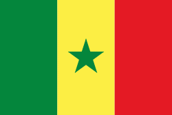
| Flag of Senegal | |
Senegal is notably the westernmost country in the mainland of the Old World, or Afro-Eurasia. It owes its name to the Senegal River, which borders it to the east and north. The climate is typically Sahelian, though there is a rainy season. Senegal covers a land area of almost 197000 km2 and has a population of around million. The state is a unitary presidential republic; since the country's foundation in 1960, it has been recognized as one of the most stable countries on the African continent.
Currency / Language
| ISO | Currency | Symbol | Significant figures |
|---|---|---|---|
| XOF | West African CFA franc | Fr | 0 |
| ISO | Language |
|---|---|
| FR | French language |
| WO | Wolof language |